Some of the worst flooding ever seen on the Chemainus River in February of this year has brought renewed calls to remove logjams and gravel bars at the root of the problem and improve the flow for spawning salmon.
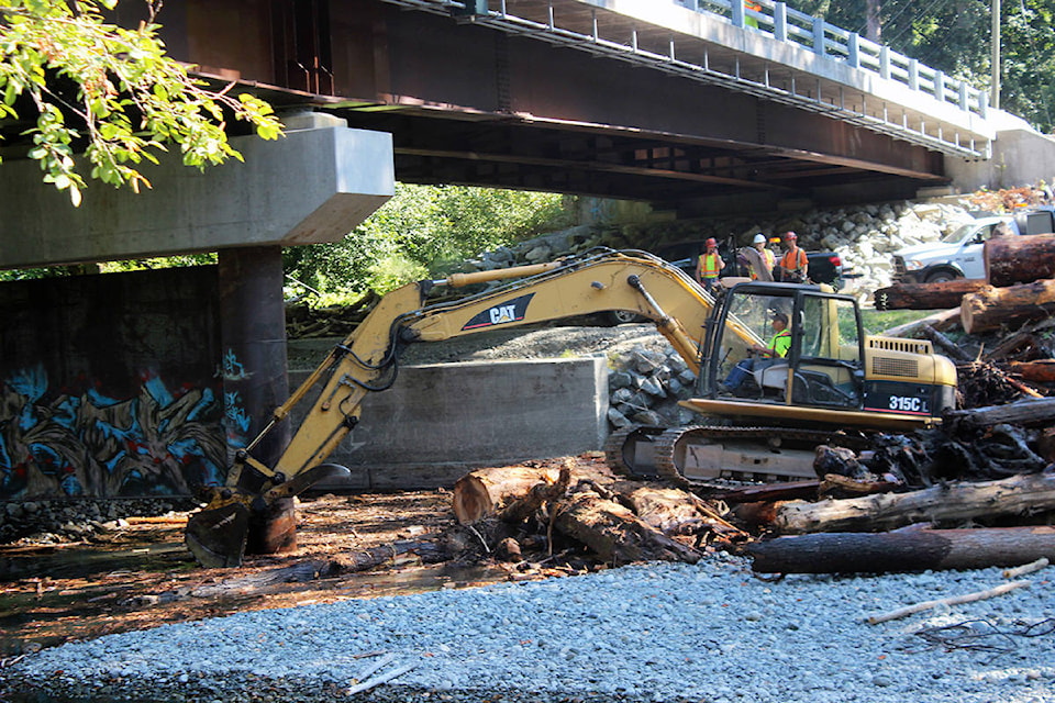
The Municipality of North Cowichan had a work crew removing logs from under the Chemainus River bridge on Chemainus Road last week, but its ability to improve the situation is limited – unbeknownst to what most people think. The reason is the multi-jurisdictional aspect of the river that essentially includes all levels of government, the Halalt First Nation and private landowners.
“The Chemainus River is a major watercourse within the Cowichan Valley Regional District and that portion of it within North Cowichan is small compared to the rest of the watershed,” explained North Cowichan’s Director of Engineering Dave Conway. “Recently many senior staff met with the Halalt to discuss immediate, short/medium and long term objectives that would improve the health of the river but this is a much larger project than the municipality could do on its own or could accomplish within municipal boundaries. Even within the boundaries there are exclusions such as the Halalt lands along the river.”
But North Cowichan is taking whatever steps it can, knowing how dire the river’s plight has become. Mayor Al Siebring and council have sent a letter to B.C. Premier John Horgan urging action and funding. Siebring has also written a letter of support to the Halalt.
“In the meantime, construction of the new bridge over the Chemainus River on Chemainus Road was undertaken by the Municipality a few years ago and its approval included the requirement to remove logs and debris from the piers if there is an accumulation,” noted Conway. “From recollection, this has occurred twice since the bridge was constructed. North Cowichan makes application to the Province and Federal governments for permission to remove the debris and that has usually been granted for late summer.”
There was an abundance of logs the Municipality extracted last week.
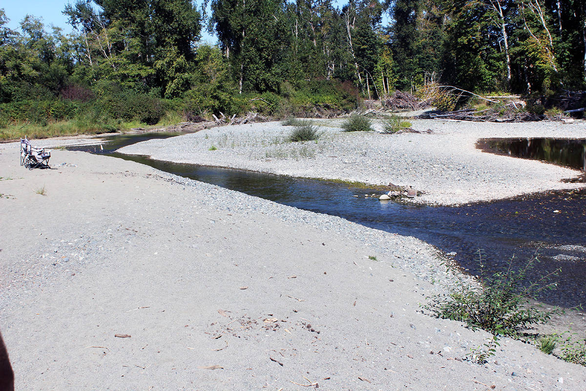
The river has been but a trickle amid drought conditions the last few summers. It hasn’t been quite as low this year due to a rainy start to the summer, but the levels are still a concern.
But then the opposite extreme happened in the early morning hours of Feb. 1 with a torrential rainstorm that accentuated the problems on the river. With nowhere for the water to go because of so many blockages, the region all around Westholme experienced extreme flooding.
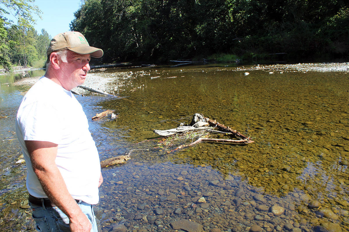
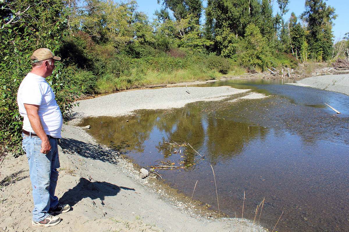
Gary McLellan of Chemainus is among the many residents with concerns and contacted Siebring in early August about the buildup of gravel below the railway bridge. McLellan presented his case over the effect the flood had on the Island Highway as well as Russell Farm Market and the Halalt First Nations reserve.
Traditionally, the gravel built up at the corner of the river downstream of the bridge and was removed annually as early as 1900 when Dan Mainguy lived there, according to McLellan.
“Val Foldy told me that Beggs Brothers removed the deposit for many years but now the bureaucrats in Victoria and mostly in Ottawa are involved and our Muni has no control over the process,” he added.
To prevent buildup and maintain a clear path for the fish, “every year it (the gravel) has to be taken out,” reasoned McLellan.
That obviously hasn’t happened and the problems persist.
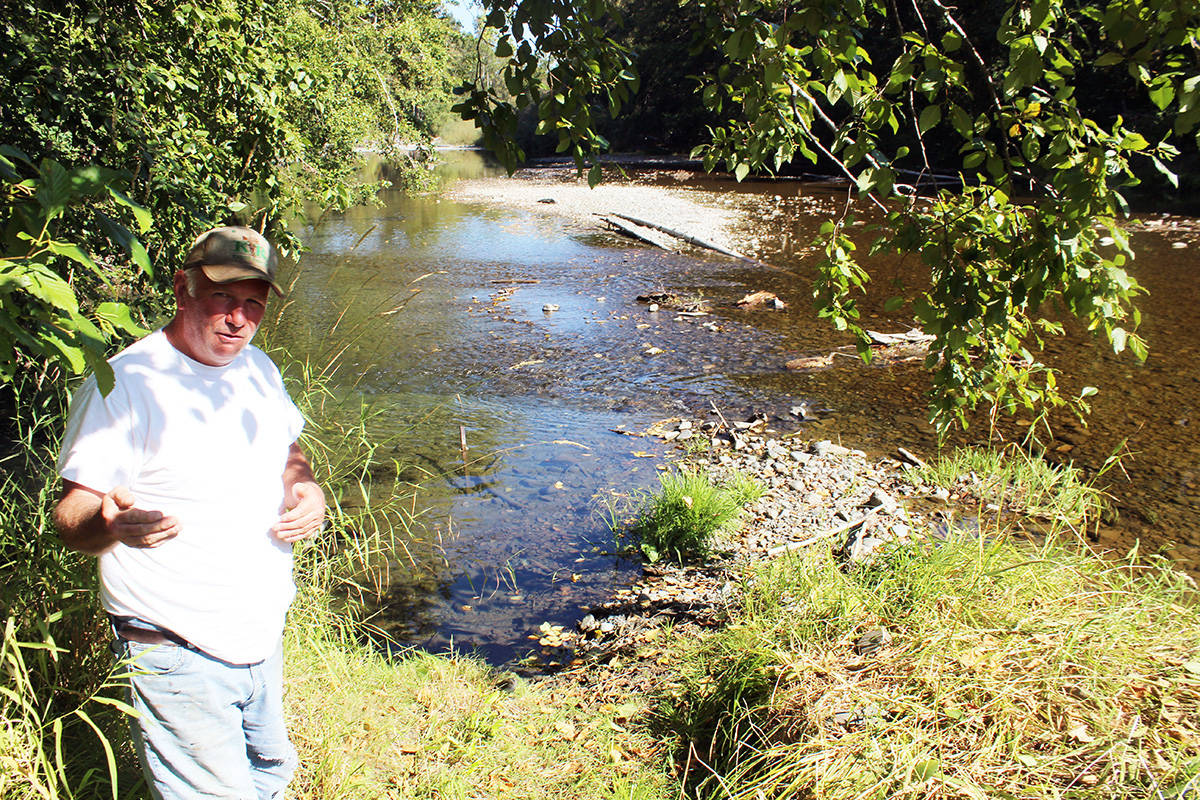
“Nobody’s been doing that for years and years now,” said Don Allingham, a lifelong resident at a 30-acre farm on Chemainus Road by the Chemainus River bridge where his property floods almost every year, but nothing like in February.
“The river’s even changed total direction,” he pointed out. “The river used to go straight. Now it cuts down and goes right through Swallowfield.
“That flood we had last winter, it wasn’t a King Tide. It came in the second bay of my barn. It’s never done that in my 58 years.”
There also wasn’t a large snowpack at the time, according to Allingham, and the river literally had nowhere to go.
“It doesn’t take a rocket scientist or engineer,” he scoffed. “If the channel’s full, where’s it going?”
When McLellan first came here in 1988, “the river was full of fish,” he said. “There’s less and less every year. Last year I went down there and there wasn’t a darn thing down there.”
There’s no excuse for inaction, according to Allingham.
“The Provincial Government knew all about it. They come down and check the water level every week on the river.”
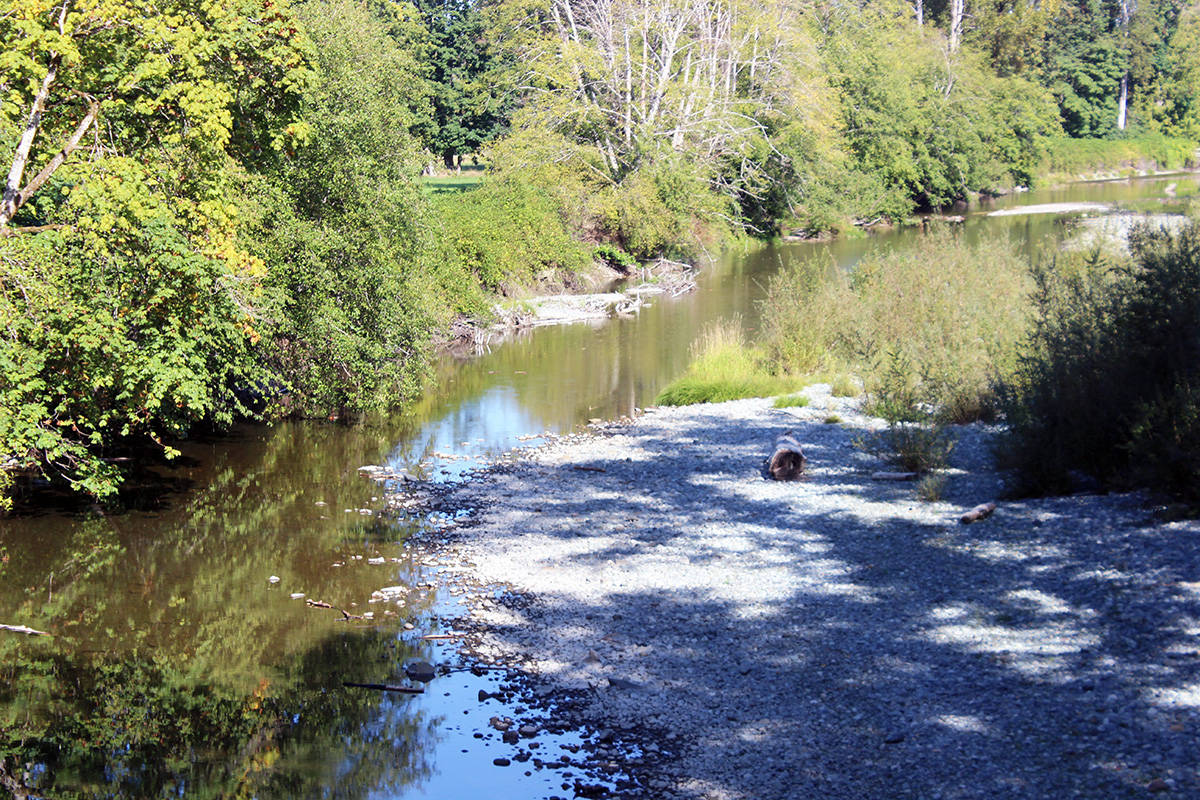
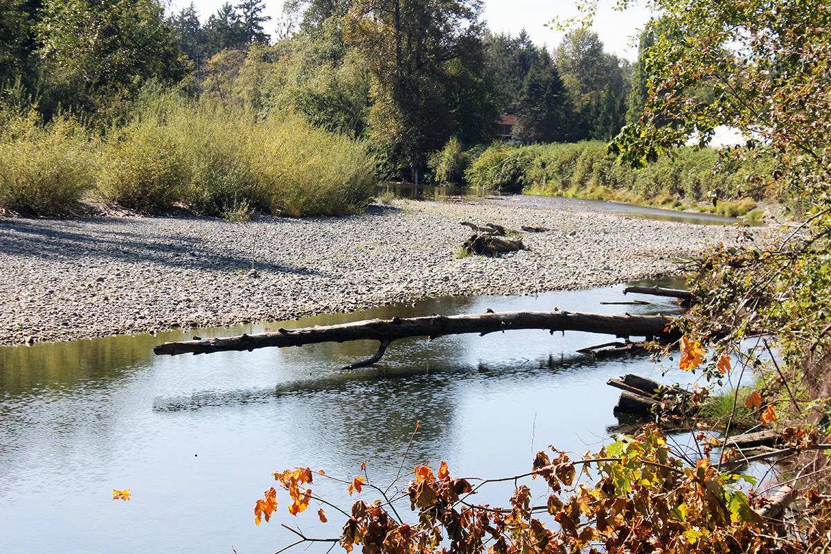
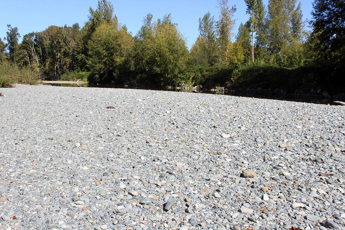
The gravel bars in some spots are quite extraordinary.
“They’re not flat gravel bars – they’re heaped,” said Allingham. “It’s a bank of gravel.
“These gravel bars were never here 6-7 years ago.”
Allingham cited the lowest piece of his property closer to Chemainus Road where “every year it floods and drops sand.”
He’s well aware of the jurisdiction issue, but “something needs to be done,” Allingham said.
The concern now is for the spring salmon that are already spawning. The water is so low in some channels they have the most narrow passageway to get upstream and many aren’t likely to survive.
Problems for the fish with low water and the risk of flooding for residents from high water are going to persist until something is done to clear the numerous logjams and gravel bars.
“It’s going to happen in a year or a year after,” said Allingham.