Four weeks ago in this space, I passed on some information from oceanographers that last winter’s La Nina event was not likely returning for the coming winter and that we should expect more normal weather conditions heading into 2018. Well, I have some good news and some bad news for those who prefer a moderate winter to anything too severe like we had around the beginning of this year.
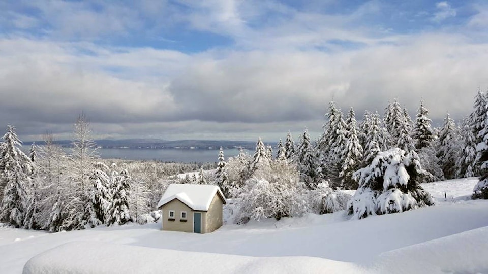
The bad news for winter-phobes like myself is that a new and unexpected La Nina has formed in the equatorial regions of the Pacific Ocean that has brought a drop in water temperatures in that very large body of water just off our coast. This may explain the unusually wintery weather we had near the beginning of this month on Vancouver Island.
The seasonal outlook has accordingly been revised to indicate somewhat below normal temperatures and somewhat above normal precipitation for the next few months. That could well mean more snow than usual for the second winter in a row. Snow-skiers rejoice!
The good news for non-winter enthusiasts is that this season’s La Nina is relatively weak. Also, the prevailing ocean temperatures and currents are not the only factors that affect our winters and there are other forces at work that could moderate the outcome.
It is too early to say for sure exactly how how this winter will play out, but statistical probabilities indicate the chances of a repeat of the epic 2016-17 winter snowfalls are very small. Those winter storms were the product of a ‘perfect storm’ (so to speak) of factors and influences that are unlikely to repeat in exactly the same way this time around.
Those relentless snowfalls constituted a ‘century event’ of the type that normally occurs only once or twice in 100 years. All the same, though, we should be prepared for another winter that will likely bring somewhat more snowfalls and below freezing temperatures than normal along the otherwise mild west coast of Canada.
As already noted, November got off to an unusually cold start this year with temperatures well below normal and sometimes below freezing during the period of the 2nd to the 7th inclusive. Although the accumulation of rain and snow was not all that great, it was one of the earliest winter events seen on Vancouver Island in recent history.
The earliestmeasurable snowfall in the Chemainus area during the past near-century for which official weather records are available was in late October of 1991, a month that is usually considered more fall rather than winter. However, if any kind of a La Nina was occurring at that time, is was very short lived. By the time the normal ‘winter’ months arrived, the temperature regime had climbed to well above average, and not a single snowflake was observed after October.
Another much more recent snowy winter that was definitely a La Nina event arrived in mid-December 2007 and continued until mid-March 2008. The Chemainus Valley area got off fairly lightly that winter because of our proximity to the moderating effects of the nearby Georgia Strait/Salish Sea, but some nearby communities further inland like the Glenora heights area near Duncan had snow on the ground for that entire three-month period.
So for now, I’m keeping a fairly optimistic spin on our local winter outlook, even if some other Island localities at higher elevations end up with a tougher road to hoe. Now that the Courier is a weekly paper, I can keep an eye on how the coming winter season continues to develop and issue updates as necessary.
Chris Carss is a Chemainus resident and a long-time weather observer/recorder.